Geography of Lake Nakuru National Park – Lake Nakuru National Park is found on the floor of the western branch of the Great East African Rift Valley in central Kenya. The park includes the soda lake, Lake Nakuru, which gives the park its name. The park is known for its interesting natural features and beautiful landscapes.
The park lies northwest of Nairobi, Kenya’s capital city. It has a rich mix of landscapes that support many types of animals and birds. These include yellow acacia woodlands, savannah grasslands, scrublands, hills, Lake Nakuru itself, and open floodplains.
Lake Nakuru National Park covers an area of about 188 square kilometers. The lake takes up about 40 square kilometers, although its size changes depending on the season. It becomes larger during the rainy season and smaller during the dry season.
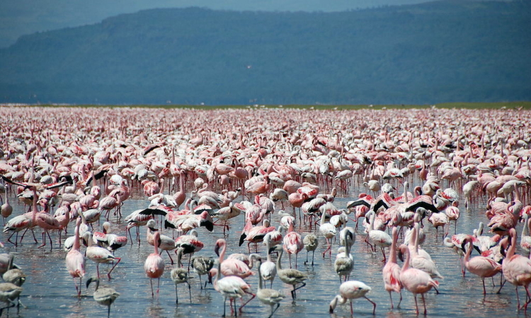
The alkaline nature of the lake supports large numbers of flamingos that feed on blue-green algae found along the shores. The lake is also an important water source for many animals, especially during dry times when other sources dry up.
Some of the major landforms in and around the park include the Rift Valley floor, Mau Escarpment, Lake Nakuru, Eburu Hills, and Lake Elementeita. There are several hills and cliffs that offer great views of the park. Lion Hill and Baboon Cliff are among the most popular viewpoints. From here, visitors can see wide views of the lake, floodplains, and wildlife such as herds of cape buffalo.
Three main rivers flow into Lake Nakuru: the Nderit, Njoro, and Makalia Rivers.
Besides flamingos, Lake Nakuru National Park is home to many other types of wildlife, including many bird and animal species.
The park can be reached easily by road using the Nairobi–Nakuru highway or by air through the Naishi airstrip, which is located inside the park.